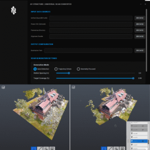
Use Case: Embed Drone Photogrammetry into Point Cloud RealViews, Convert SLAM LiDAR to a format compatible for merger with (Drone) Photogrammetry
Benefits: Increased Data Flexibility, Increased Desktop Workflow Efficiency, Replace Terrestrial scope with Expedited SLAM hardware
How is it making an impact?
Reality Capture is a growing market. Specific to the drone industry, the data collected must be compatible with other databases and data types. As it relates to point clouds and photogrammetry, only structured point cloud datasets can be used as an anchor for drone or other photogrammetry. The issue is structured datasets are exclusively created from terrestrial scanning equipment. Drone LiDAR as well as most mobile LiDAR today relies on SLAM capture, which only outputs unstructured data. AV Structure converts that unstructured data to structured data using the poses and photos that accompany SLAM LiDAR data and/or the photogrammetry data collected as well. Virtual waypoints are generated and structured e57 point clouds are created.