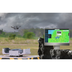
V360 Weather Platform is an operational intelligence system designed to close the critical gap in modern aviation and ground operations: accurate, actionable weather insight at low altitudes where traditional systems fall short.
V360 integrates multiple data layers—including government sources (METARs, radar, satellite), commercial providers, and TruWeather’s proprietary sensor networks—into a unified operating environment. This includes fixed and mobile sensors, customer-deployed systems, and emerging low-altitude data sources that increase spatial and temporal resolution.
The result is a high-fidelity, real-time weather picture at neighborhood, corridor, and street scale.
Drone delivery operators use V360 to evaluate weather conditions along planned routes before launch. By combining radar, METARs, proprietary sensor data, and localized low-altitude observations, the platform identifies wind shifts, gusts, visibility issues, and other micro-weather risks that traditional forecasts may miss. The operator can adjust timing or routing, issue alerts, and make a confident go/no-go decision—reducing aborts, improving safety, and increasing mission reliability.