September 1-3, 2026 • Caesars Forum • Las Vegas
What is it?
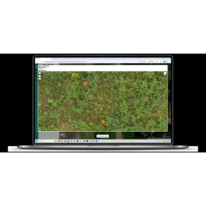
The POLLi platform is used by drone operators to store and manage images for both manual and automated review. POLLi’s proprietary, integrated machine learning models automate object identification and habitat classification. It establishes a shared, standardized framework for collecting, analyzing, and reviewing drone imagery. Unlike traditional mapping tools that stitch images into a single large map, POLLi keeps track of each image individually. This process keeps a clear record from the original camera capture to the final GIS output. This enables organizing and searching for both corridor data, such as right-of-way routes, and large land areas in a single place. Findings in vegetation, or assets, can be reviewed with confidence.
Who is using it?
Commercial drone operators use POLLi to manage large photo sets and deliver more consistent results. Many service providers get buried in imagery and weak workflows. POLLi helps by reducing the need for high-overlap flights, letting pilots cover more ground per battery; organizing outputs into standard, GIS-ready formats; and using a governed process that supports more consistent machine learning results across pilots, seasons, and sensors.
How is it making an impact?
In a habitat assessment study focused on research and evaluating right-of-way compliance, POLLi’s methodology was 4x faster than traditional survey and data collection methods. Compared to traditional ground surveys, which took 120 minutes per site, UAV-based data collection and image review took 30 minutes. Besides speed and cost savings, personnel safety and reporting were also enhanced by: