


What do pilots, fleet managers, and commercial drone operators actually think about the state of the commercial drone industry? Earlier this year, Commercial UAV News and Pilot Institute set out to find out, surveying the
…

As drone programs expand from small, localized projects to enterprise-level operations, maintaining precision across massive, multi-flight datasets often becomes a major bottleneck. The outstanding question facing today's geospatial professionals is: Can you truly scale UAV
…


State Departments of Transportation have moved well past the question of whether drones deliver value. The real challenge now is building programs that scale across divisions, districts, and mission types, all without sacrificing safety culture,
…


The architecture, engineering, and construction industries have moved well past proof-of-concept drone deployments. The question now is how to embed aerial data collection into core workflows in ways that drive real operational value: better planning,
…


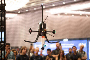
With Part 108 on the rise, commercial drone traffic will become exponentially higher in the next year. While this is an exciting advancement for industry, the influx of traffic in the airspace means more opportunities
…
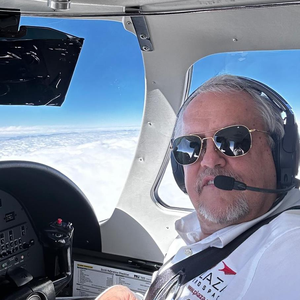
Learn to bring Aviation Safety Culture into the drone industry and into your own missions with Commercial Airline Pilot and UAS SAR expert Kyle Nordfors.

Drone-based surveying is in the midst of a significant transition as new capabilities expand what’s possible, evolving standards re-shape how work gets done, and the operational realities on the ground fail to match the headlines.
…


As more universities are looking to implement new UAV programs of study or keep already established programs up to date with the latest UAV applications, faculty and administration are left to set standards, determine best
…As drone data collection becomes standard practice across surveying, engineering, and infrastructure projects, the ability to merge UAV datasets with mobile mapping, terrestrial lidar, ground-penetrating radar, and other capture methods is becoming an increasingly critical,
…
Flying the drone is the easy part. Turning that data into something your client actually values? That's where the real work and the real money is. Jared Janacek pulls back the curtain on his full
…
Don't risk your reputation by not knowing essential site safety professionalism. You may not need to be OSHA certified to fly construction sites, but you should know the safety best practices to be professional, reduce
…
Large companies are going all in on drones and building serious internal programs to prove it. In this session, get a rare inside look at how they do it, what makes these programs succeed, and
…

What do pilots, fleet managers, and commercial drone operators actually think about the state of the commercial drone industry? Earlier this year, Commercial UAV News and Pilot Institute set out to find out, surveying the
…As drone programs expand from small, localized projects to enterprise-level operations, maintaining precision across massive, multi-flight datasets often becomes a major bottleneck. The outstanding question facing today's geospatial professionals is: Can you truly scale UAV
…State Departments of Transportation have moved well past the question of whether drones deliver value. The real challenge now is building programs that scale across divisions, districts, and mission types, all without sacrificing safety culture,
…The architecture, engineering, and construction industries have moved well past proof-of-concept drone deployments. The question now is how to embed aerial data collection into core workflows in ways that drive real operational value: better planning,
…With Part 108 on the rise, commercial drone traffic will become exponentially higher in the next year. While this is an exciting advancement for industry, the influx of traffic in the airspace means more opportunities
…Learn to bring Aviation Safety Culture into the drone industry and into your own missions with Commercial Airline Pilot and UAS SAR expert Kyle Nordfors.
Drone-based surveying is in the midst of a significant transition as new capabilities expand what’s possible, evolving standards re-shape how work gets done, and the operational realities on the ground fail to match the headlines.
…As more universities are looking to implement new UAV programs of study or keep already established programs up to date with the latest UAV applications, faculty and administration are left to set standards, determine best
…As drone data collection becomes standard practice across surveying, engineering, and infrastructure projects, the ability to merge UAV datasets with mobile mapping, terrestrial lidar, ground-penetrating radar, and other capture methods is becoming an increasingly critical,
…Flying the drone is the easy part. Turning that data into something your client actually values? That's where the real work and the real money is. Jared Janacek pulls back the curtain on his full
…Don't risk your reputation by not knowing essential site safety professionalism. You may not need to be OSHA certified to fly construction sites, but you should know the safety best practices to be professional, reduce
…Large companies are going all in on drones and building serious internal programs to prove it. In this session, get a rare inside look at how they do it, what makes these programs succeed, and
…